
Wichita Falls Street Workflow
A street-by-street search works best when each source answers one narrow question. Start with the address in the Wichita County Appraisal District record, because its advanced form can pair a street number range with a street name. That result supplies the current owner name and parcel details. Ownership is different from occupancy, so keep the result as a property lead rather than a household conclusion.
- Enter the address, or a number range and street name, in WCAD Advanced Search. Record the situs, current owner spelling, parcel or account identifier, and legal description.
- Use that owner and legal description in the Wichita County EagleWeb deed portal. A purchase deed can identify a grantor, recording reference, and prior transfer trail.
- For a named person, use the official VoteTexas status process or contact the Wichita County voter registrar. It is a one-person verification route, not an open list of everyone on a street.
- For an older address, compare the yellow street-address sheets in Worley directories and the telephone books. A criss-cross entry is evidence from its publication date, not a current roster.
Keep the property record, deed trail, voter status, and directory entry in separate notes. They describe different times and different relationships to the same Wichita Falls address.
Wichita Falls Address Search Fields
WCAD provides the most direct public entry to a Wichita Falls street directory search. Street number low and high fields can narrow a segment, while city, ZIP, neighborhood, and property filters help distinguish similar addresses. The form does not establish how many results, pages, or exports a live search will return, so those limits should be checked in the active interface.
| WCAD field | Form type | Required | Street use |
|---|---|---|---|
| Street number low/high | Range | Optional | Browses a segment or side of a block. |
| Street name | Text | Optional | Use normalized suffix and directional variants. |
| City and ZIP | Text | Optional | Separates a mailing label from a municipal line. |
| Neighborhood | Text | Optional | Narrows a subdivision or local neighborhood label. |
| Owner or business name | Text | Optional | Finds owner-linked parcels, not every occupant. |
| Property, CAD, or owner ID | Text | Optional | Provides stable account keys. |
| Property type | Radio | Optional | Includes real property, manufactured home, natural resource, and personal property. |
| Status and tax year | Select | Optional | Compares tax context; visible option values were not captured. |
| Legal description | Text groups | Optional | Uses abstract, subdivision, block, tract, or lot details. |
| Acres low/high | Range | Optional | Filters larger or rural tracts. |
The WCAD Advanced Search screen shows the address and legal-description fields available for a Wichita Falls street directory query.
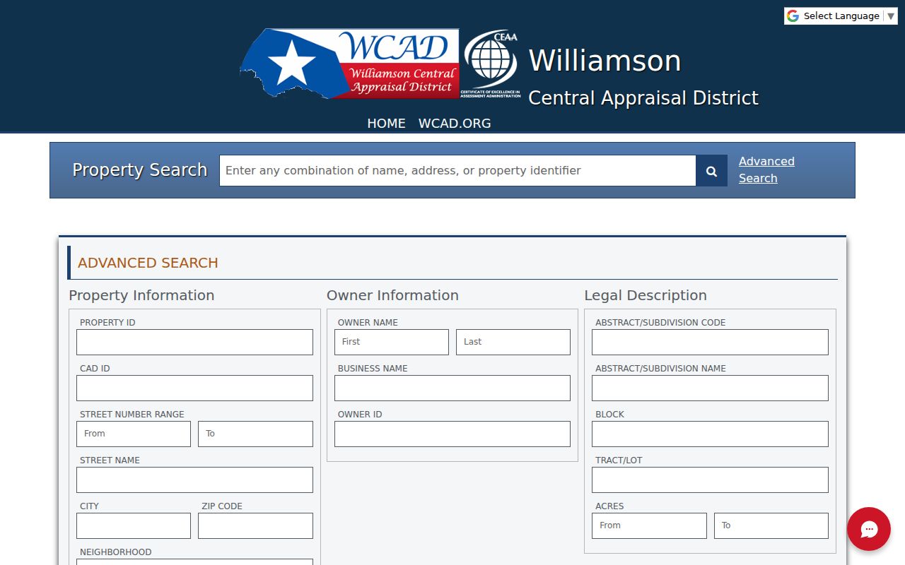
The field set is useful because it permits a street range, a ZIP, and a subdivision description to work together rather than relying on a single street label.
Note: A WCAD owner result ties a person to property, but it does not confirm present residence at the situs address.
Wichita Falls Parcel Map Layers
After a parcel appears in WCAD, the map can place it among nearby parcels. The City of Wichita Falls Development Interactive Map adds layers for parcel data, zoning, floodplain, historic districts and sites, easements, water and sewer mains, thoroughfare planning, and several district boundaries. These are property and planning layers, not resident lists.
The inspected city description confirms those layers but does not document a formal adjacent-parcel, buffer, or measure tool. For an easement or utility question, Public Works is the documented interpretation contact. Map geometry helps test whether two records concern the same lot, especially where an older address and current street number do not line up.
Wichita Falls Address Records
Several Wichita Falls records can be keyed to an address, but they do not all answer the same question. The property roll establishes a current parcel relationship. A plat describes land layout. A deed records a conveyance. Permits and code files can date work at a structure. The coverage below keeps those limits visible.
| Address-keyed record | Custodian | What it can show | Access route |
|---|---|---|---|
| Parcel and property roll | Wichita County Appraisal District | Current owner, parcel, situs, mailing address, tax context, and legal description. | WCAD web search and map; phone or in-person fallback was not located. |
| City GIS layers | City of Wichita Falls | Parcel geometry, zoning, floodplain, utilities, easements, and historic layers. | Public city map; Public Works for interpretation. |
| Recorded deed and plat | Wichita County Clerk | Grantor, grantee, recording details, legal description, liens, and plat references. | EagleWeb, courthouse terminal, or older microfilm. |
| Tax roll context | WCAD and county tax offices | Assessment, tax year or status, owner, and exemption indicators. | WCAD tax-year field or a tax-office request. |
| Building permit | City Building Inspections | Permit type, address, work scope, dates, and named contractor or owner. | EPR for applicants; city request for historical files. |
| Code Compliance | City Code Compliance | Address, complaint or case, and inspection or action dates. | City public-information request; no public case search was found. |
The WCAD Property Search is the current-property starting point captured for this Wichita Falls street directory.
Use a parcel identifier and legal description to keep the county record, city map, and recorded document trail tied to the same property.
Wichita Falls Deed Chain
A recorded deed index is name-based, not a parcel search. Start with the WCAD owner and legal description, then search that owner as grantee in EagleWeb around the likely purchase period. Record the grantor, grantee, recording date, instrument or book and page reference, legal description, and any prior-instrument reference shown in the index.
Then search the seller as a grantee in earlier years for the same legal description. A plat may bridge a lot and block to a street address. When the deed uses metes and bounds, search both the parties and the description. The County Clerk landing page requires acknowledgment and cookies; its static view did not reveal the live search fields or an online cutoff. The courthouse terminal remains a documented option.
The older fallback is unusually specific: Texas State Library reels cover Wichita County direct and reverse deed indexes for 1873 through 1917. Direct indexes group grantors, while reverse indexes group grantees. A useful quirk for the research log is that Volume 38 is absent and Volume 35 contains tax deeds. That is a known microfilm gap, not proof that a transfer did not occur.
Note: A deed traces a legal transfer, so it should not be treated as a current locator for either party.
Wichita Falls Street Record Access
Online searching is only one access channel for a Wichita Falls street directory question. WCAD, its map, the city development map, and EagleWeb provide current online entry points. EagleWeb’s landing page requires cookies and an acknowledgment, and its static view did not reveal the live deed fields or a coverage cutoff. A blank online result should therefore be treated as a prompt to check the index route, not as proof that no document exists.
At the courthouse, the County Clerk is the recorder for deeds and recorded instruments, while public-access terminals and the appropriate clerk counter provide the fallback for indexes and copies. The Clerk lists Room 250 at 900 7th Street, a county main line with option 1, and weekday hours; use the counter, phone, or mail route to ask which index or copy process fits the document. City Building Inspections and Code Compliance files can be requested by address through the city public-information channel. When a request has costs, ask the custodian for an itemized estimate before ordering copies. The exact countywide central request portal or email was not identified in the reviewed official material.
For the early deed period, the Texas State Library Wichita County guide identifies direct and reverse index reels and deed books. Midwestern State University’s Moffett Library serves as the regional historical-resource depository contact, so a requester can ask for the documented reel number when the web portal stops. This comparison matters: the online portal is convenient, while microfilm makes older coverage and missing volumes visible.
Wichita Falls Permit Trails
Building records can add dates and work descriptions to a Wichita Falls address trail. The city’s Building Permits materials and electronic plan review process show that permits are issued and uploaded. No public historic address-history index was verified. For a specific file, provide the address, permit number if known, approximate construction or alteration date, and contractor or owner name.
Code Compliance records can likewise be requested by address through the city’s Public Information Request route. A permit date may document an addition, demolition, or rebuilding event. It does not by itself establish a sale or identify every person associated with the property.
The city permit page is represented in this Wichita Falls street directory capture.
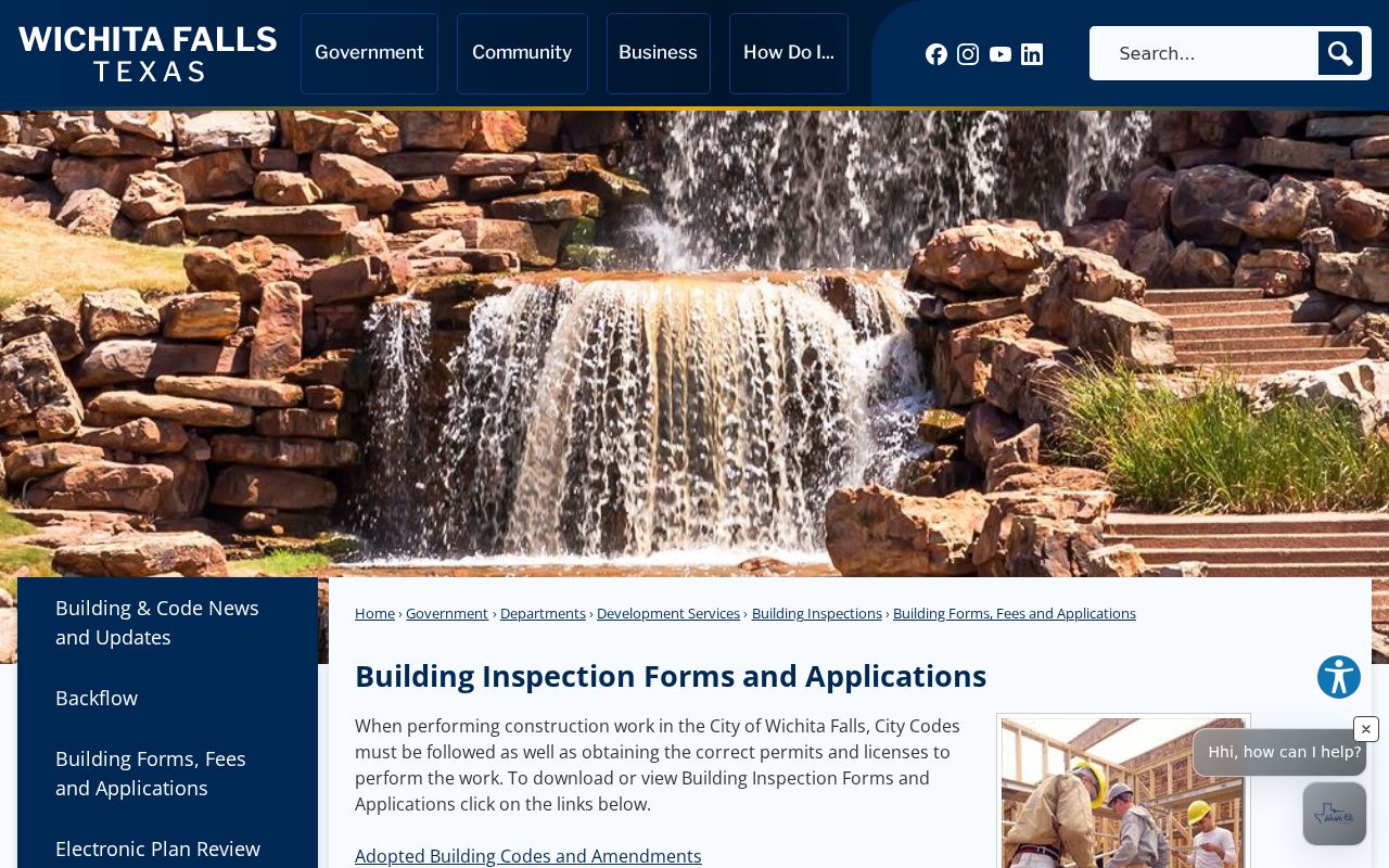
The forms and permit material support an address-specific request, while the lack of a verified historic index keeps the search from becoming a broad street roster.
Wichita Falls Address History
Historical address sheets add a different time layer to a Wichita Falls street directory search. The 1910 directory included yellow street-address sheets, and reverse or criss-cross arrangements pair an address with the listing printed for that date. Worley directories are documented from 1907 onward in scattered runs, while telephone directories extend from 1909 to 2005 with gaps.
Read the street and alphabetical sections together, then check the abbreviation key and whether an entry names an occupant, subscriber, or business. The UT Briscoe Center's Worley citation identifies verified local runs. Historical collection access belongs with the Wichita Falls city directory collections; use it when the question moves from a present parcel to an older household.
Wichita Falls Address Gaps
Street numbers are useful labels, but lot, block, abstract, tract, and metes-and-bounds descriptions survive address changes better. The terms below connect the records that recur in a Wichita Falls street search.
- Parcel
- A mapped property or account used by the appraisal district.
- Situs address
- The location of the property, which can differ from the owner mailing address.
- Plat
- A recorded map that lays out lots, blocks, streets, easements, or a replat.
- Criss-cross directory
- A reverse address arrangement that lists a printed occupant or subscriber by street location.
City rules require new streets to avoid duplicate or confusing names, and aligned extensions continue an existing name. They also require city-limit lines to be marked in or out on plats. No official source identified a citywide renumbering or renaming year. Preserve old spellings and number forms, then bridge them with plats, Sanborn maps, directory sheets, City Planning, and the City Archive rather than inventing a conversion date.
Annexation can also shift which records office controls a question. WCAD and the County Clerk serve the wider county, including places that use a Wichita Falls mailing label outside the city line.
Wichita Falls Street Directory Limits
A street directory does not create a complete household list. Property records may name an owner whose correspondence goes elsewhere. Voter status tools are restricted to a named person and protected addresses can be suppressed. Directory and telephone listings reflect their publication date and do not include every household. Utility customer data and motor-vehicle addresses are not public resident rolls.
Use a street record to verify a property, trace a deed, understand a historic structure, or conduct careful family-history research. Do not turn a parcel map, an old directory, or a mailing address into a claim about who currently lives at a Wichita Falls home.
Lawful use. Use Wichita Falls address records only for lawful personal, family-history, property, or civic research. Do not use them to stalk, harass, intimidate, or harm another person.